 Catalalogue de l'ORE OMERE
Hydrological networks
Type of resources
Available actions
Topics
Keywords
Contact for the resource
Provided by
Formats
Representation types
Update frequencies
status
Scale
-
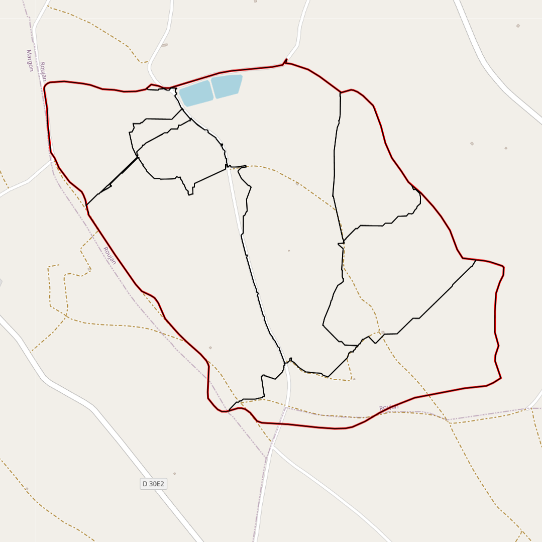
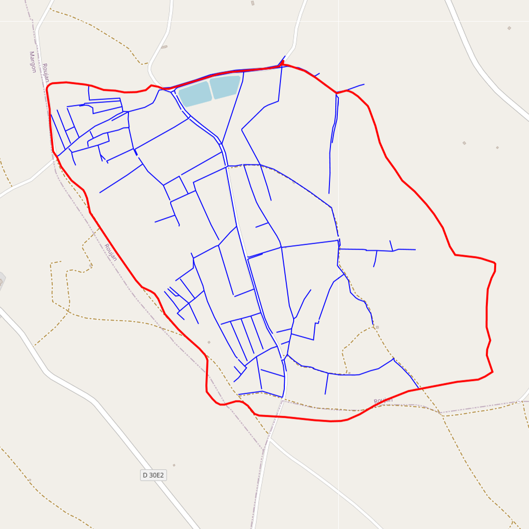
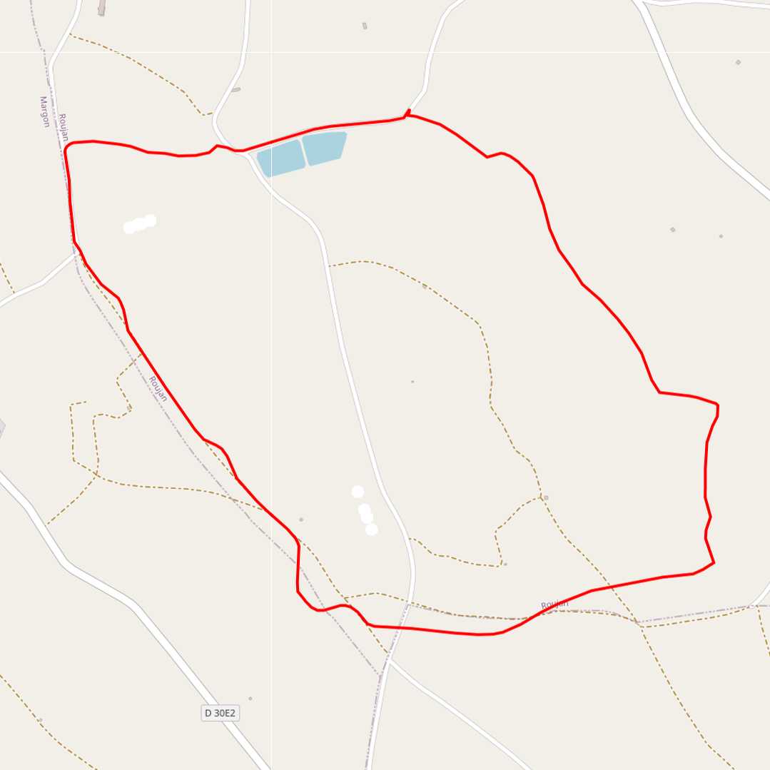
Contour map of the sub-catchment areas (Roujan)
-
-
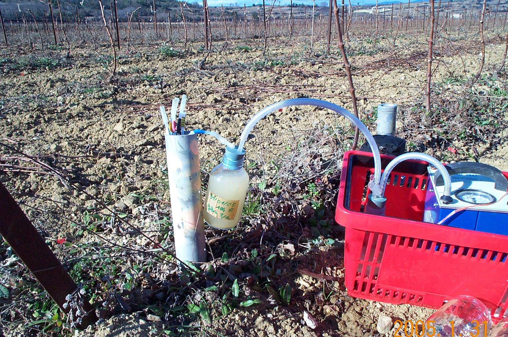
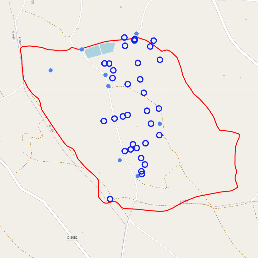
The water table depth from the soil surface is measured at different points in the Roujan catchment. In Roujan site, the groundwater is shallow with a free surface water table rising and falling in the soil and subsoil layers. The measurements are made at different points in the catchment with piezometers. A piezometer is a perforated PVC tube at its base installed in the soil through a borehole. In every piezometer, the water table depth is measured by manual piezometric probe or monitored at high frequency (~15') with autonomous and automatic probe integrating acquisition units. Through the OMERE data portal accessible from this website, the data can be downloaded from an interactive map.
-
Contents of trace metals in water (rain, run off, underground waters ) on the Roujan catchment area.
Regular sampling of surface water, rainwater or groundwater is carried out in the Roujan catchment area. These samples are sampled and analysed in order to assess the content of trace metals in the waters of the basin.
-
Pesticide contents are determined on the suspended matter extracted by filtration (0,7µm) in runoff water. Contents allow quantification of particula transport of pesticides and allow too compare it to solute transport.
-

water samples ( rain, runoff, underground water) are carried in icebox and frozen. ( FILTRATION ? ). Samples are analyzed by a dedicated laboratory, that quantify a set of parameters including from 1 to 430 pesticide active ingredients and their metabolites.
-
Water sampling in rain, runoff and undergroundwater are performed on the fields and send to a specialized laboratory to quantify major elements contents (Ca, Mg, Na, K, SO4, PO4, HCO3, NO3) ( FILTRATION ???. PH ??? ? EC, ???)
-
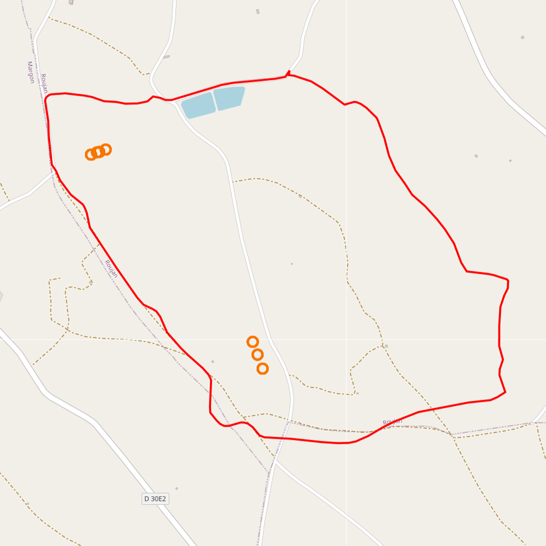
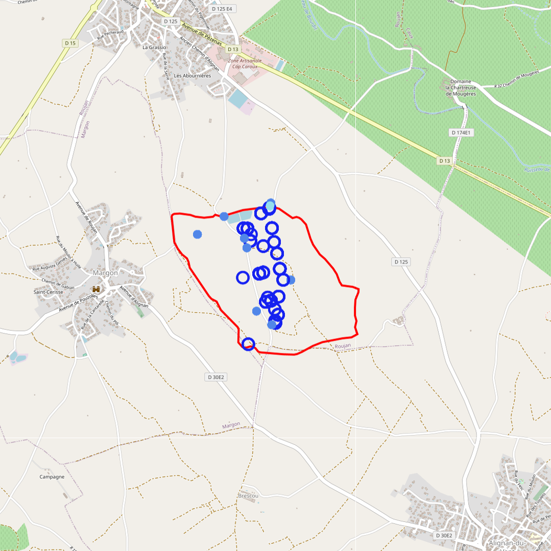
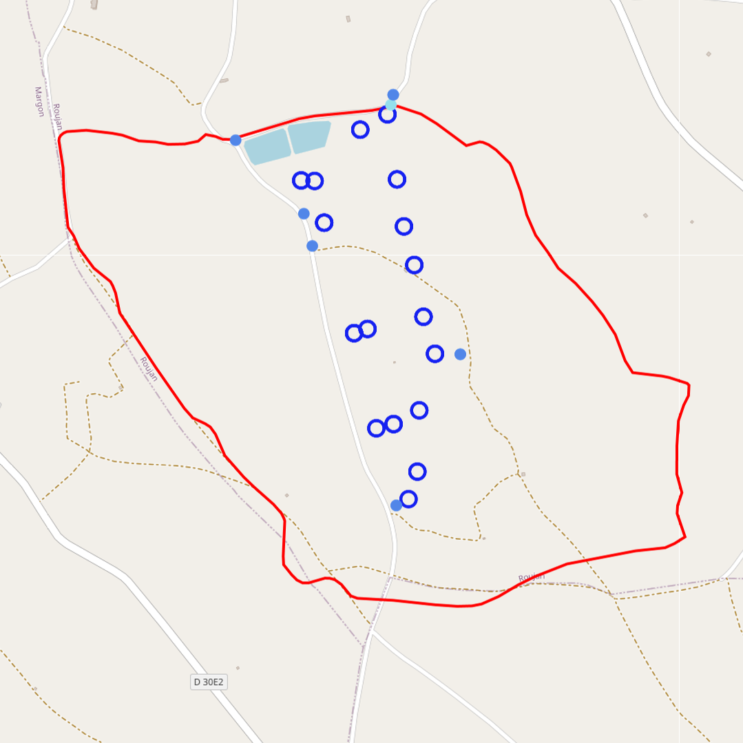
The thematic map provided allows you to visualise the measurement points concerning this data acquisition device. This map is accessible via a standardised WMS flow, but also enables the data sets associated with the measurement point to be downloaded, depending on the case, via the ORE OMERE data portal.
-

The groundwater temperature is measured at different points in the Roujan catchment. In Roujan site, the groundwater is shallow with a free surface water table rising and falling in the soil and subsoil layers. The measurements are made at different points in the catchment with piezometers. A piezometer is a perforated PVC tube at its base installed in the soil through a borehole. In every piezometer, the groundwater temperature is monitored at high frequency (~15') with autonomous and automatic temperature probe integrating acquisition units. Through the OMERE data portal accessible from this website, the data can be downloaded from an interactive map.
-
Isotope analysis of groundwater, rainfall and surface water in the Roujan watershed area. Samples of rainfall accumulated over a day or an event as well as instantaneous samples of runoff and groundwater are sent to a specialized laboratory to determine their oxygen 18 and deuterium contents.